An SLD file is a GIS file that has been created in a Styled Layer Descriptor format.
Styled Layer Descriptor is a XML format that describes details about map layers.
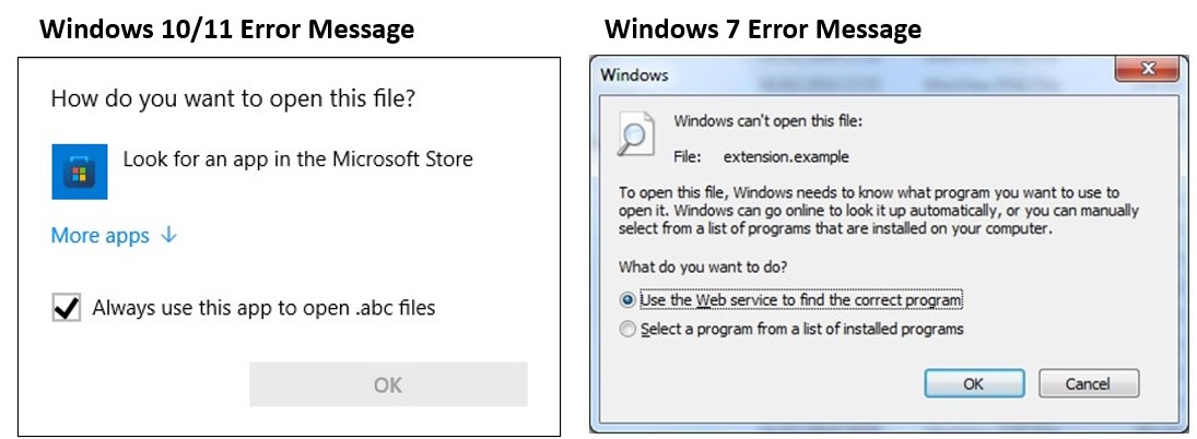
 .sld File
Extension
.sld File
Extension
An SLD file is a GIS file that has been created in a Styled Layer Descriptor format.
Styled Layer Descriptor is a XML format that describes details about map layers.